 Adobe Community

Copy link to clipboard
Copied
Thanks to Steve Grisetti's awesome tutorial on YouTube, I can now add an animated travel map to my travel video. For those of you who do this... What maps do you use? I love Google Maps in general, but I can't figure out how to save them as an image other than using a snippet tool, and the snippet tool is too imprecise. So what do you guys use for your map images?


 1 Correct answer

I usually start with one map (screen capture from Google Maps, for instance), make a copy of it and then use Photoshop Elements to manually draw the line of travel on one of the copies.
Glad you found the tutorial helpful, Joshann!
 6
Replies
6
6
Replies
6

Copy link to clipboard
Copied
Any map you find can will allow a "screen shot". On a PC, press "prt sc" and it puts the screen image on the "clip board". Now you can "paste" into Photoshop, or whatever, and save it as necessary.
A little "reality" can be added if you use your camera and take a picture of a road map.
Bill
Copy link to clipboard
Copied
I thought of using a screen shot, but that poses a similar problem as using the snippet tool. The problem is that I actually need two maps that are almost identical. One without the route I took shown on it and one with the route shown on it. So, for example, I could go to Google maps and take a screen shot of a map that shows my starting point and my destintion with no route drawn on it. Then "get directions" from Google, and take a screen shot of the same map with the route showing on it. So now I've got two screen shots. The problem is that a screen shot shows everything that was on your screen including menus, toolbars, etc. So I could edit the screen shot with Paint or Photoshop or something, but the problem is that it is extremely difficult to edit both of the screen shots so that the resulting two files are exactly the same except for the route. As you know, the two maps have to be exactly the same except for the route for you to be able to create an animated route.
It's hard to explain what I mean. I hope I just made any sense...
Copy link to clipboard
Copied
I usually start with one map (screen capture from Google Maps, for instance), make a copy of it and then use Photoshop Elements to manually draw the line of travel on one of the copies.
Glad you found the tutorial helpful, Joshann!
Copy link to clipboard
Copied
Thanks! Darn! I was hoping someone was using some kind of other maps that work better/easier for use as image files. Oh well. I will use your suggestion Steve. I just suck at drawing anything free hand, even if it is just tracing, so we'll see how well I manage to draw my route on my map. LOL!

Copy link to clipboard
Copied
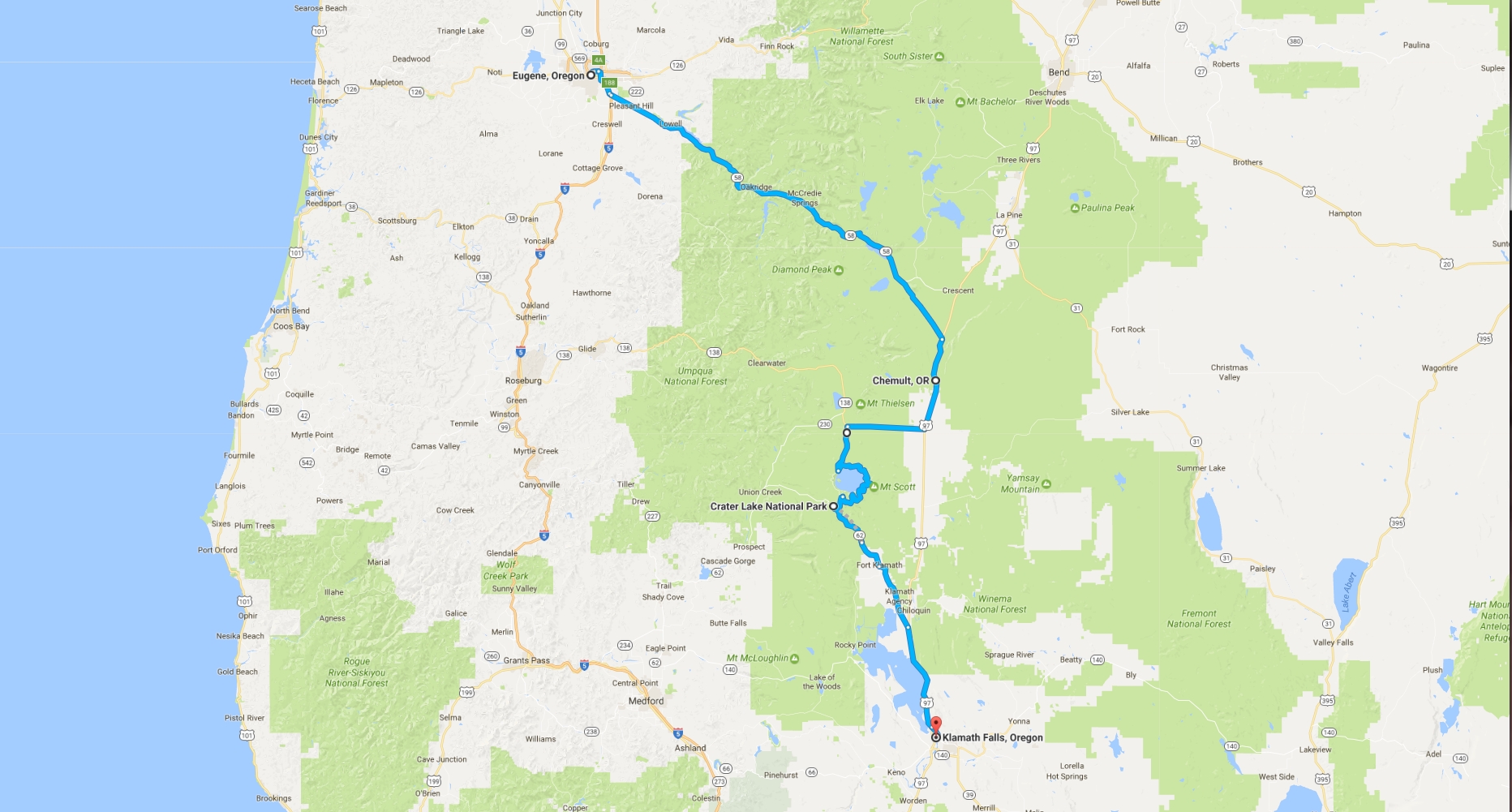
Actually with Google maps & some trial-and-error one can get them to draw the route.
See attached example showing a route from Eugene to Klamath Falls with detour to Crater Lake (from an upcomming video of part of our US vacation in October 2016).
Copy link to clipboard
Copied
Joshann wrote
Thanks to Steve Grisetti's awesome tutorial on YouTube, I can now add an animated travel map to my travel video. .......

 AdChoices