P: Add ability for pano merge feature to read gimbal position metadata from drone files
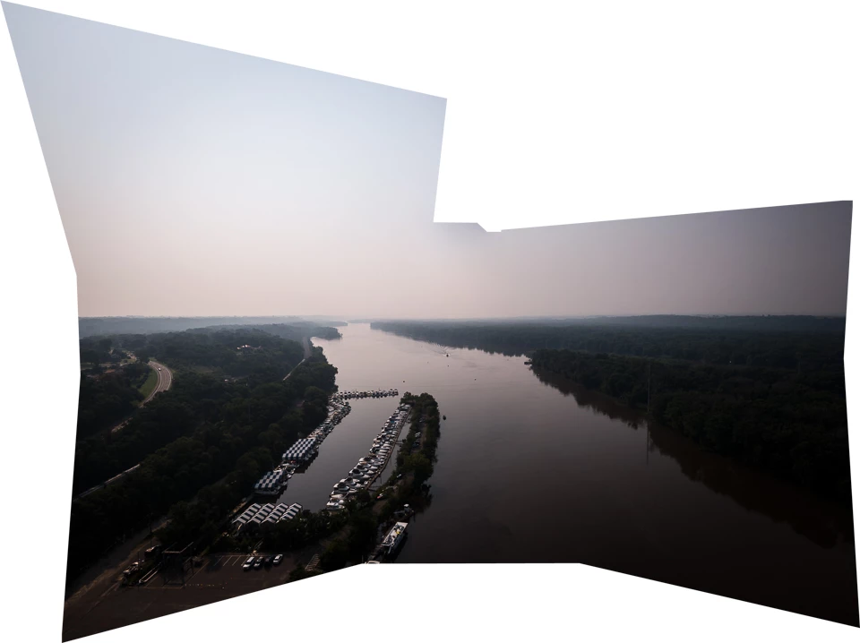
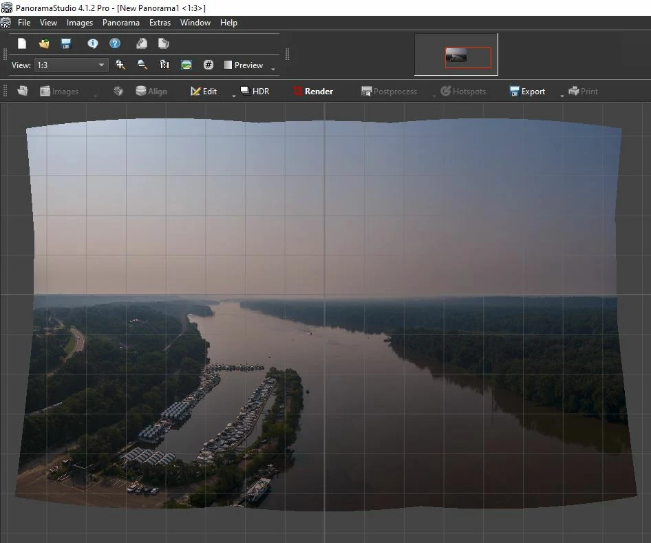
Stitching panos is especially problematic when there's a clear blue or otherwise featureless sky. Often, in fact virtually always, LrC chops off corners of the sky that were in the original captures. It's also nearly impossible to shoot a 3x3 with the horizon perfectly centered, which is normally desirable to maintain verticals. LrC will essentially chop off the entire top of the sky and screw up the perspective of the remainder. The only workaround is to center the captures slightly below the horizon so the top row has some ground included at the bottom. Oh, and a large expanse of water in the lower portion of the pano can also be problematic. Before LrC added the pano feature, I had been using PanoramaStudio Pro (I'm currently using v4.xx), which has an option in its initial Align dialog to "place non-aligned images using metadata." This evidently reads gimbal position metadata from the files, and I don't believe I've ever had it fail. But using that app involves a much slower, more complex workflow - export from Lr, set alignment, view initial result and tweak adjustments if necessary, render the full-res pano, export a perspective projection from it (usually), then manually import that image to LrC as a TIFF for final processing. I'd really love it if LrC had the ability to read that gimbal metadata in the same fashion. Here's one example of what LrC often generates. That top right corner wasn't missing, LrC just mangled it. Like I said, it happens virtually 100% of the time when the sky is relatively featureless. The second image is the same 9 exposures stitched with PS4Pro using the metadata feature. And you might also notice that it automatically corrected the horizon position, which was actually above-center in the original captures, so I don't have to use a transform to fix the verticals. PS4Pro will always render multiple row panos using a spherical projection, but then allows numerous other projections to be generated and exported from it. Anyway, I'd love it if LrC had the ability to read that gimbal metadata and stitch all my drone panos flawlessly, not just the ones with cloudy skies and no large expanses of water.