Answered
Can illustrator export image include Geo Tag (GPS location) in PREXIF?
I use script to export image from illustrator to PNGs. Can illustrator export images attached GPS location with altitude/latitude inside PREXIF?
I use script to export image from illustrator to PNGs. Can illustrator export images attached GPS location with altitude/latitude inside PREXIF?
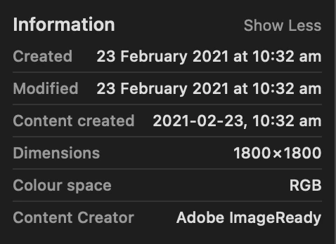
I doubt it. I exported a png file via a script and looked at the exif data (see screenshot below—this would be where longitude and latitude would appear). Also I haven't seen any meta-data related features in the exporting functions exposed to scripting. Your best bet might be to use an extra tool (eg. exiftool) to add the exif data after exporting.
Already have an account? Login
Enter your E-mail address. We'll send you an e-mail with instructions to reset your password.