Answered
Creating an interactive airspace map
Hi I'm very new to Captivate so I apologize if this is already a thread somewhere.
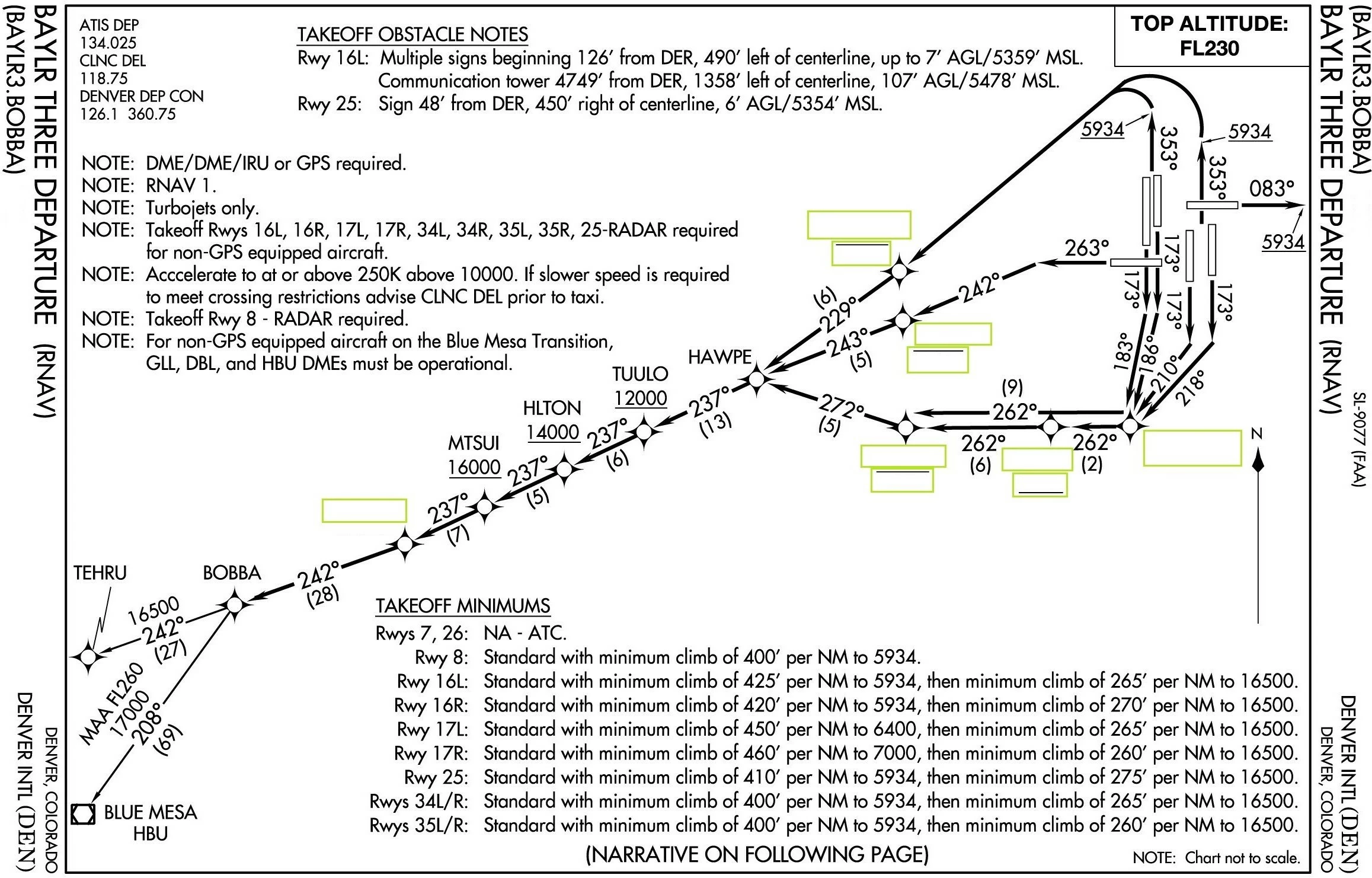
I work for the FAA and am trying to create airspace and air route exams. We currently have paper (hard copies) I'm trying to make them computer tests. Essentially I have a Chart with blanks and need those to be the "fill in the blank" that will correspond with the correct altitude. See attached pic below any help will be greatly appreciated.