

How to make railway stations by script ?

Copy link to clipboard
Copied
Hello,
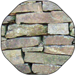
I have question: simply how having what is on pic. A to make what is on pic. B by script ?
I guess it is not so easy so I can pay for making this.
----
More explanation: I have railways as lines and railway stations as dots. I can easy make stations with a proper symbol (white rectangle), but it should to be aligned along the railway. And I have many stations like these.
Thank you,


Explore related tutorials & articles
 47
Replies
47
47
Replies
47

Copy link to clipboard
Copied
Luke,
If the rectangle to the left is the station, there seems to also be an introduction of fancy architecture.
Copy link to clipboard
Copied
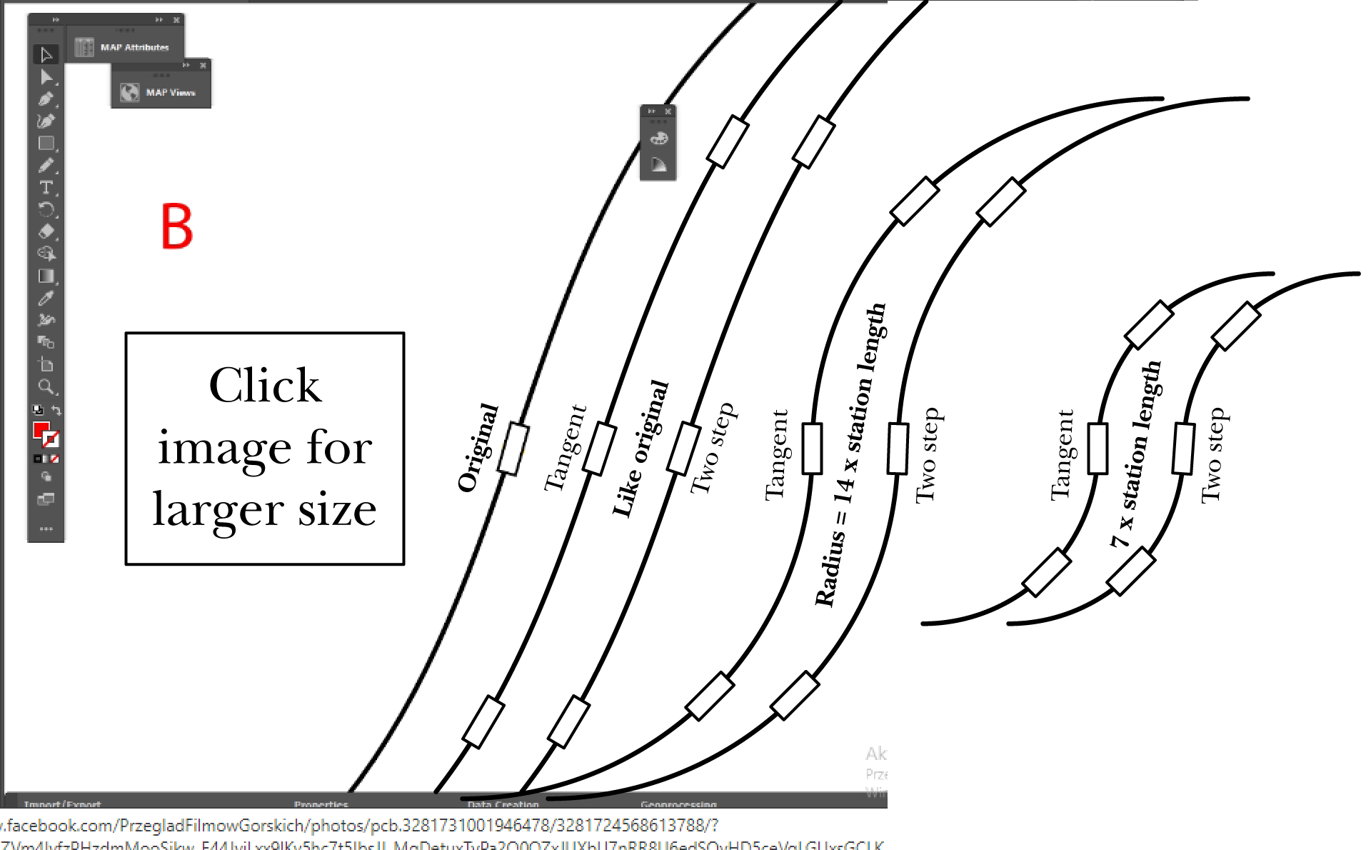
That's not a station, it's a swimming pool . It's what happens to a rectangle when the minimum number of curve points is selected and the Corner Point Angle Threshold is set to zero, four points becomes two points.

Copy link to clipboard
Copied
Still a fancy one, Luke, apologizing for the bad joke.
Copy link to clipboard
Copied
I will provide an .ai with proper scale.
But please, guys, it is tough, I want pay somebody for that.
Copy link to clipboard
Copied
Thank you Kurt_Gold for your comments.
But the problem is this is OpenStreetMap data and they have it solved like this.
Yes, I am aware the stations are aside, not on the line. They just mark building stations in this way. And this that they are aside makes the biggest problem. Somehow solved at these map images renders which I showed you in different project before. So I wonder how they did it. That's why I said it was not easy.
I may give you other examples, but they will be similar. It is OSM data like this.
Also, I see many examples here made by users are good enough. The bigger problem is the proper location on line, when the station is beside.
Anyway, thank you all for the help and the effort.
Copy link to clipboard
Copied
Beff,
I have added a part to the previous drawing, roughly corresponding to the curve at the station in Roppen.
Copy link to clipboard
Copied
Jacob, your stations look beautifully, but how you make them according to the dot, which may be aside of railway line ?
Copy link to clipboard
Copied
Jacob, may I ask you how you do it by Tangent ? You mean this Plug-in of Astute ?

Copy link to clipboard
Copied
I'm pretty sure that there may be some other useful approaches to build the stations.
At least if one or a couple of useful sample files were provided.
Copy link to clipboard
Copied
OK, so here it goes the .ai which is done.
And yes, I use 500cm format for any trials with maps.
Copy link to clipboard
Copied
And here is a start: https://we.tl/t-nw2KgbhCHV

Copy link to clipboard
Copied
Beff,
Je suis entièrement en accord avec Jacob, un grand ménage s'impose.
Un peu comme ci dessous:

https://share.orange.fr/#UmTPZ4gGeJ3cc00c318a
PS Je travaille avec la version CS6, ce n'est pas évident de pouvoir ouvrir ton fichier...
Conseil, Pour présenter un exemple toujours enregistrer (si c'est possible) sous une version plus ancienne.
Mon script place une station (symbole N°6 dans la liste des symboles) à chaque point sélectionné.
René
Copy link to clipboard
Copied
Magnifique, as always, Rene.
Sure, I can union all fragments to make them one.
Also, I can extract a "main" line when there is a big density, also service lines. It is not a problem.
I can do it before processing.
Copy link to clipboard
Copied
also, this is OSM data, which I get on input. It is like that and I can only modify that.
Copy link to clipboard
Copied
Beff,
I agree with Kurt and René that the files are inferior, and I believe that it would be better to start over.
The angular shape (polylines) is particularly outstanding in the left side of the bottom curve, and I believe that alone would make the map unusable; passengers might wonder whether they would need crash helmets and/or seat belts.
Moreover, there are numerous paths (190 or more in the three versions), and the length of the straight segments are quite different, and varying within each path, so there are many inconsistencies; also some (not quite) overlapping parts.
If you could get/create a better and more consistent single path, preferably curved, otherwise with segments short enough to make the angularity (sufficiently) inconspicuous, that would be the right start.
Possibly, the only/most viable way would be to redraw the railway line from the map in AI, the map forming the (locked) template (layer).
If you must, you can:
A) Delete the wrong paths,
B) Change from polylines to curved paths, maybe as a combination of simplifying and rounding corners (differently for different paths), undo being your friend,
C) Join the paths into one path.
Whichever way you (can) choose, to answer your two latest placing/rotating questions:
"... how you make them according to the dot, which may be aside of railway line ?"
No need for this if you redraw and snap the centre of the station (and no need to start with a dot).
Otherwise, it depends on the accuracy of the lengthways position of the dot: is it sloppily placed or displaced from the line at a right angle?
If it is sloppily placed, just move it to where it fits with the real station (you will need the map underneath).
If it is displaced from the line at a right angle, and if
If it is displaced from the line at a right angle, there are different ways, one (set) for curved paths and one (set) for polylines.
"... how you do it by Tangent ? You mean this Plug-in of Astute ?"
I am referring to the tangent formed by the Handles of a (newle created) Anchor Point on a curved path; but that Anchor Point is unneeded if you use the station end centre way (with chords as Kurt mentions).
Copy link to clipboard
Copied
Jacob, but it is like this which I get on input. It is not perfect.
What I can do with it more ? Union them into one path and get rid of service paths.
Redrawing it's a manual work.
I will prepare you one bezier curve. It is not a problem.
Copy link to clipboard
Copied
I think I have a (probably) promising idea to at least semi-automate the creation of the nice stations, in the meantime better known as the Jacob stations.
Let's see what may happen.
Copy link to clipboard
Copied
They can be Jacob_Rene_Kurt stations 😉
Copy link to clipboard
Copied
or different according to alphabethical order. No offence to anybody.
Copy link to clipboard
Copied
This is an approach that uses actions. You can download the following file:
https://drive.google.com/file/d/1_t-4KQgya6nP13GJa5j8QgZFI3kwlLyF/view?usp=sharing
It contains a sample Illustrator file (jacob_stations_001.ai) and an action set file (jacob_station_maker.aia).
Instructions:
- Open the sample Illustrator file. Don't select anything.
- In the Actions palette, load the action set file.
- Play back the action called "chord_preparer" and take notice of the message at the end of the action.
- Then play back the action called "make_jacob_stations".
Copy link to clipboard
Copied
Very interesting approach, Kurt.
You divide a curve to the segments, and later make stations from selected parts.
But I have two questions:
A. Can I make the shorter segments to scale up the size of the stations ?
B. In my geographical programs, when I have two layers with vector objects, I can "transfer selection" from one layer to the second, to the objects which lay under. And can I make such "transfer of selection" also in AI ? Then I could automate it more -> I make dots bigger an bigger to be tangent to the line or even crossing the line. Then I select the "dots layer" and transfer the selection to the parts, which are under. And voila!
Copy link to clipboard
Copied
A)
Yes, the dimensions are variable. You can have any size you need. What is your desired size?
B)
I think that is possible as well, but I'm not quite sure if I completely understood your request in that case.
Copy link to clipboard
Copied
I think It is okay. I can work with this. Thank you, Kurt 🙂
-
- 1
- 2

 AdChoices