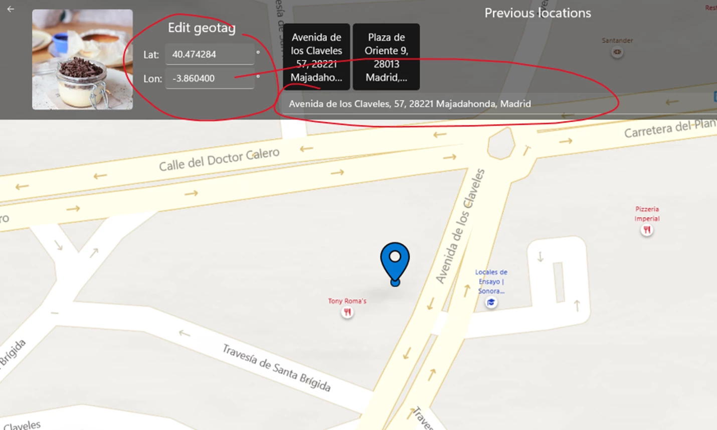
What I see when inspecting the file using Jeffrey Friedl's Metadata Viewer plug-in (which uses Phil Harvey's ExifTool) is in the attached screenshot:
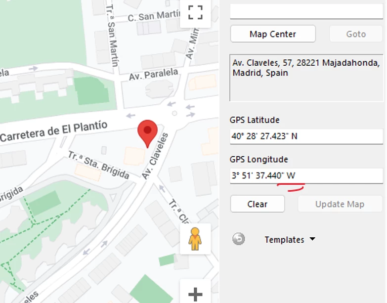
You will see that the GPS coordinates appear in two different places (presumably written that way by the GeoPhoto Pro app). The correct GPS data is in the EXIF section of the file's header, the incorrect GPS data appears in the XMP section of the file's header. Obviously LrC is reading the XMP data....which I would probably expect, but with raw images such as your CR3 files any additional XMP data is usually contained in XMP sidecar files. Maybe that's a bug in LrC, but as the acknowledged metadata expert @johnrellis will have a much better explanation as to why this is happening and if he thinks that LrC shouldn't be reading that XMP data from an original proprietary raw file.
Summary: The GeoPhoto Pro app has a bug, writing a different value into the XMP GPS fields than the corresponding EXIF fields. LR also has a bug -- it should prefer EXIF over XMP when both are present.
Gory Details
To build on Jim's reply, here's another view of the GPS fields stored in the file (also produced by Exiftool):
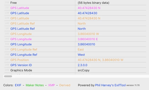
[EXIF] GPS Version ID : 2.3.0.0
[EXIF] GPS Latitude Ref : North
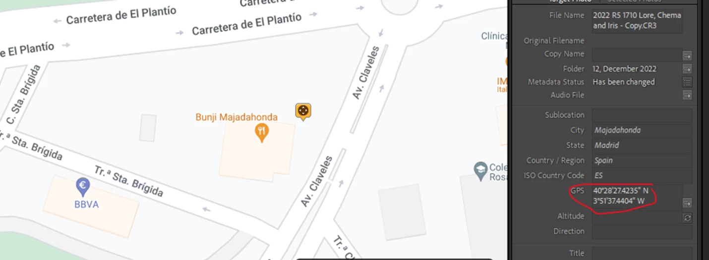
[EXIF] GPS Latitude : 40 deg 28' 27.42"
[EXIF] GPS Longitude Ref : West
[EXIF] GPS Longitude : 3 deg 51' 37.44"
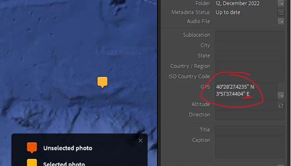
[XMP] GPS Latitude : 40 deg 28' 27.42" N
[XMP] GPS Longitude : 3 deg 51' 37.44" E
As Jim observed, the EXIF longitude is West while the XMP longitude is East. That's clearly a bug in GeoPhoto Pro. The easiest workaround is to run this command in the Command prompt after running GeoPhoto Pro and before importing into LR:
exiftool -xmp:all= *.cr3
(You'll have to download and install the free Exiftool.) That will delete the erroneous XMP fields.
Jim asks about the presence of XMP in raw files. In general, LR does read XMP fields from raw files if no .xmp sidecar is present. This is by design: Some cameras store in-camera star ratings in XMP, and newer Nikon cameras have started writing default Develop settings into .nef files, which LR uses as camera-raw defaults.
There are two reasons why other apps may be showing the EXIF fields rather than the XMP fields. First, many apps don't implement the XMP standard (I vaguely recall that Windows File Explorer does not). Second, the industry standards are ambiguous about whether to prefer XMP or EXIF when both are present. The original XMP spec gave precedence to XMP, but the later Metadata Working Group standard gives precedence to EXIF (with some exceptions, which don't include GPS).
LR does a pretty good job of following MWG (Adobe was one of the instigators of MWG), but it looks like in this case it isn't correctly following MWG, giving precedence to XMP. I'm not going to bother filing a bug report about this, because I'm certain, based on past experience, it will just go into the bit bucket. Even if the LR team did eventually decide to fix it, it would most likely be at least 6 months, probably longer, which won't be of any use to you in the meantime.