Is there a better way to create a map in photoshop?
Copy link to clipboard
Copied
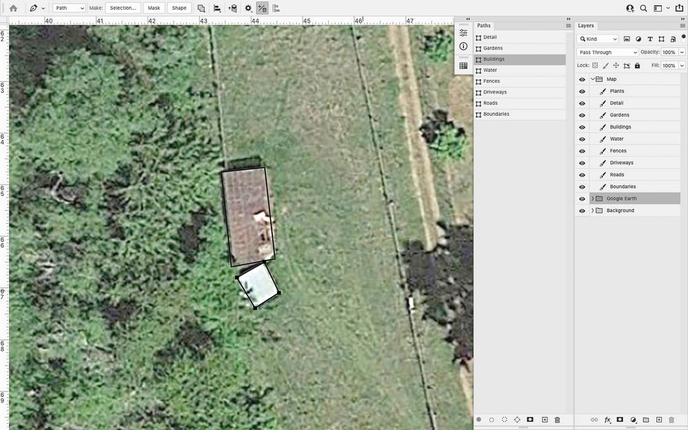
Here's my workflow:
I have a google earth picture as a reference
I am creating paths (not shapes) for roads, buildings, and other features
When I am happy with a path, I "stroke path" onto its corresponding layer.
This is large property and there will be hundreds of features at different levels of detail.
I figure this approach will allow me to create and edit paths, and "print" them to layers at the very end.
However, I have no idea what I'm doing and invented this method myself.
Does anyone have any advice for me? Is there any way to do this better? I'd like to get the method figured out before I dive further into this project.
See photos below for an example of what I am doing. Thanks for any help with this.
Explore related tutorials & articles
Copy link to clipboard
Copied
Perhaps it will help you 3D MAP GENERATOR – ATLAS
Copy link to clipboard
Copied
This is cool but it doesn't help me with what I'm trying to do in the slightest
Copy link to clipboard
Copied
Is there a reason that you don't use the pen tool to create shapes, and have the path stroked, so that you can edit it later? You can keep the paths in groups.
Copy link to clipboard
Copied
While it can be done this way - Illustrator is about a hundred times more convenient and efficient for this. I'd see this as a great opportunity for some hands-on Illustrator training.

