
Map module dragging images is HIGHLY inaccurate
One of my clients is a company that sell space on advertising displays. I photograph the displays for them, it is often difficult in the photographs to tell which display is which so I need to accurately GPS tag the images.
Today is the first time I have manually geotagged images since the LR Classic upgrade, and LR is no longer placing the pins where I drop the images.
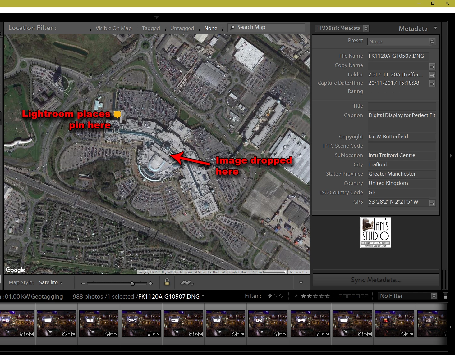
Take a look at the image above and you will see the problem. I have 11 different locations I need tag within that shopping centre, The level of accuracy that LR is proving is not acceptable to me (nor my client). I used to be able to do this very accurately so that my client and I could very quickly identify which image relates to which location in the shopping centre.
I have confirmed that the GPS coordinates that are embedded in the image relate to where the pin is shown NOT to where I dropped the image.
Can anyone help, please?