Hi @Jambo_88 ,
to add something to @Robert at ID-Tasker 's wonderful solution:
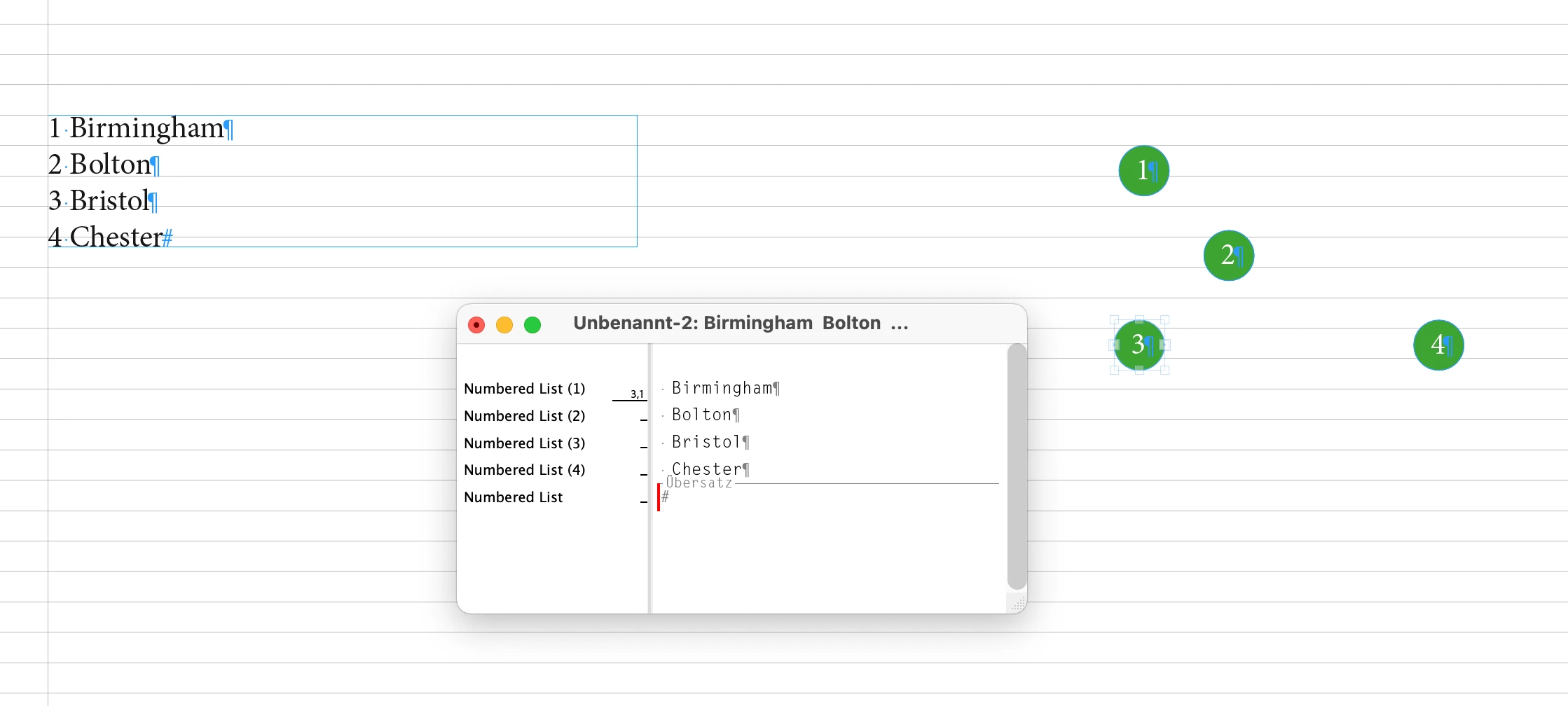
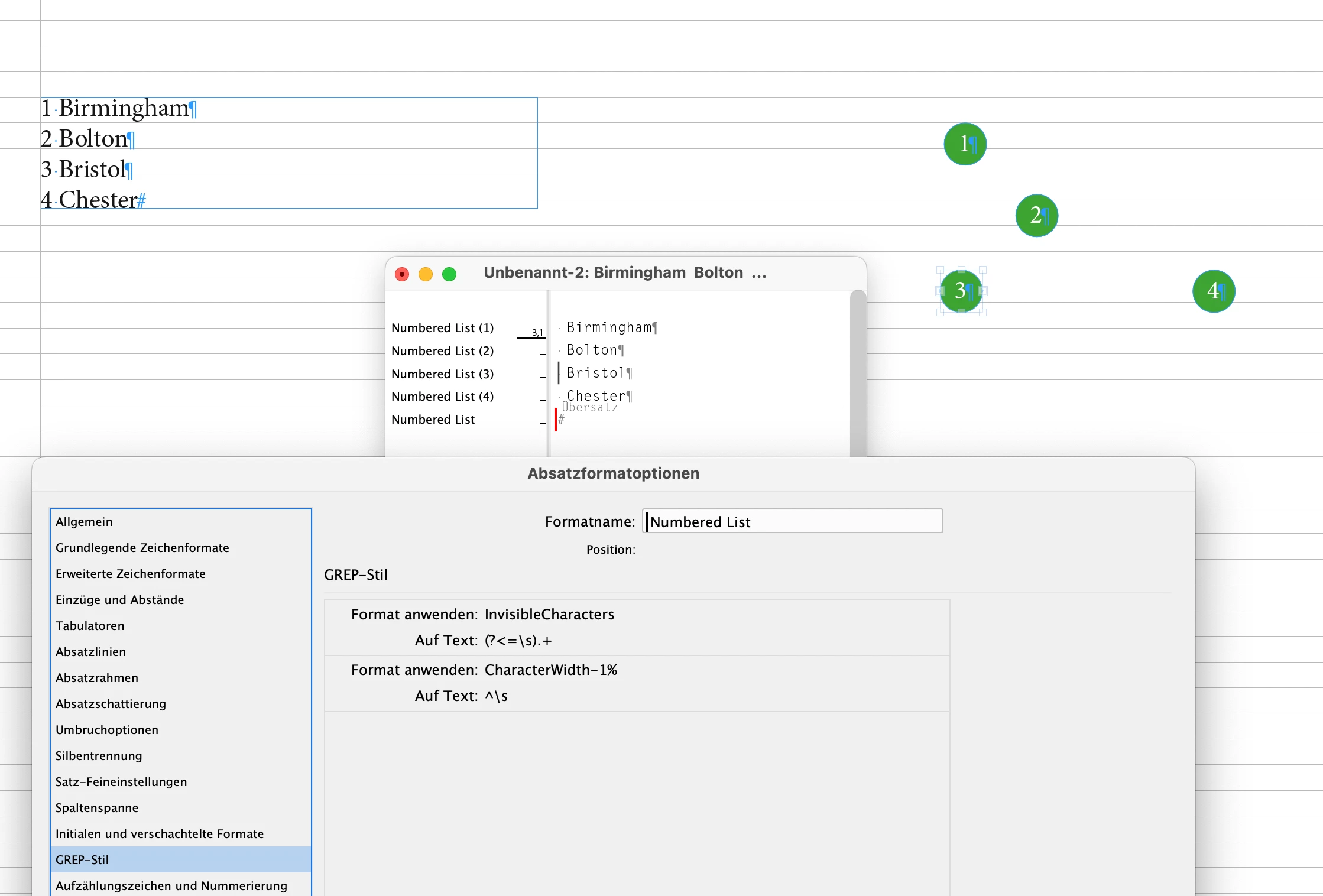
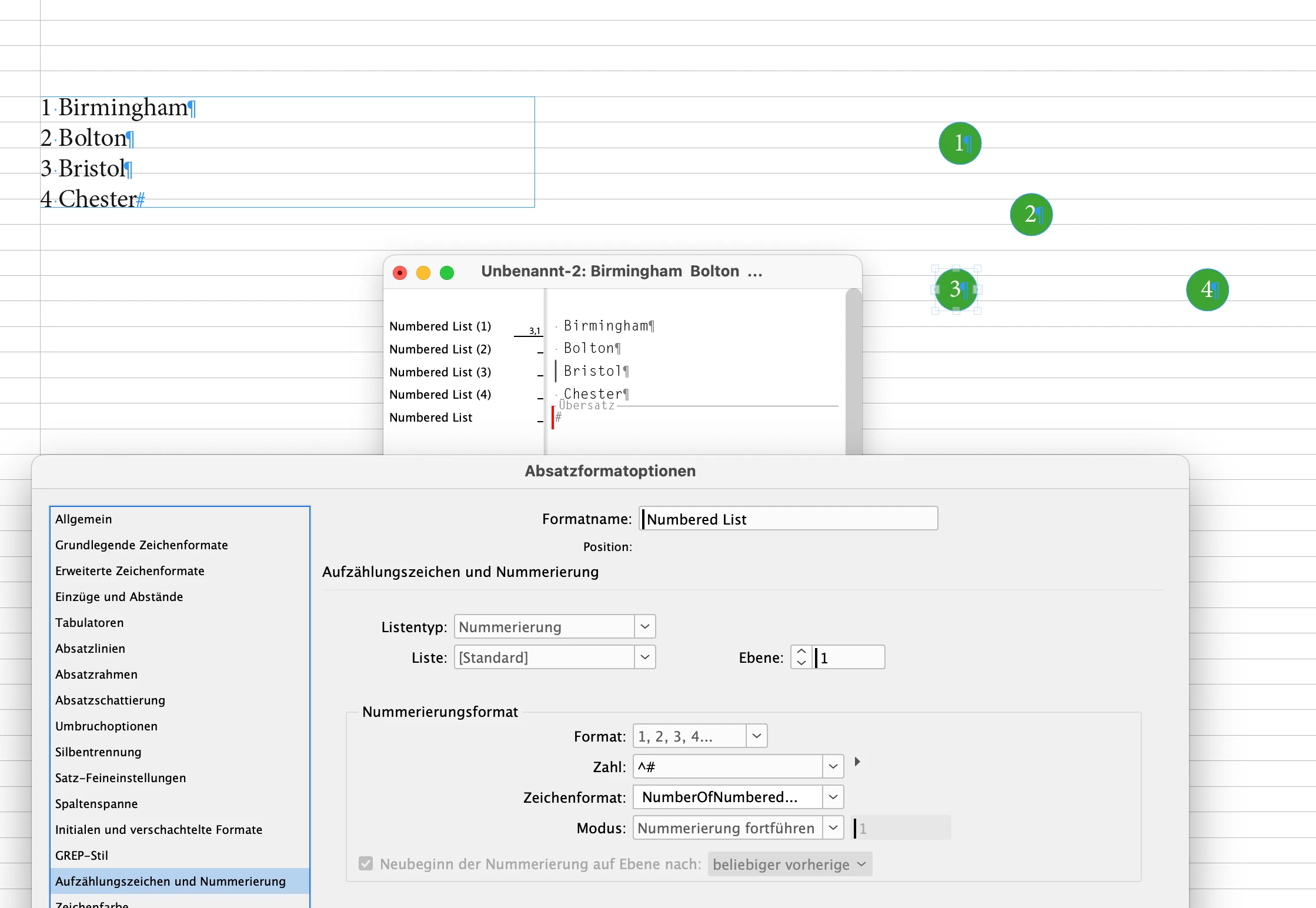
I can see a set-up of elements on the page where the "legend" of the map can be updated semi-automatically with an InDesign menu command:
First of all think of full paragraphs in every circle element that contain the whole information. The auto number of a list plus the location in plain text. The location part is formatted as "invisible" with a GREP style in the applied paragraph style. Point size 0.1 Pt, character scaling set to 1% and fill color "None" of the applied character style.
To edit an item use the Story Editor window.
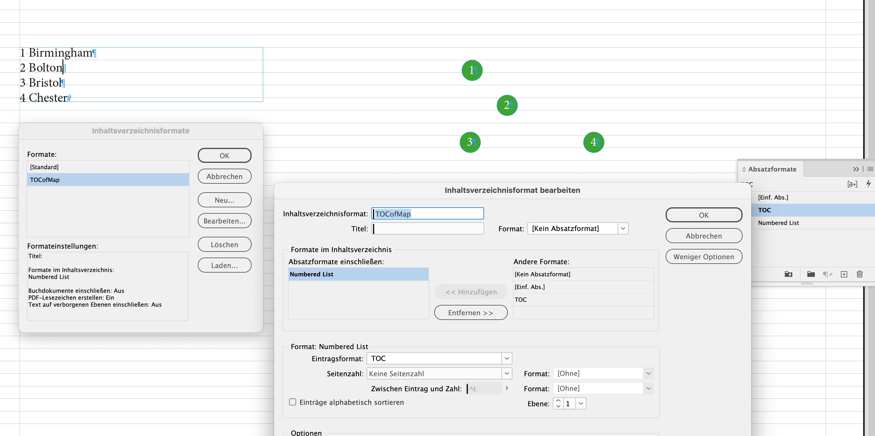
Then do a Table of Contents with a distinct TOC Style that uses a separate paragraph style that pulls all the information to a TOC that you can update after making changes to the threaded text frames on your map.
See screenshots in no particular order from my German InDesign and the attached file MapLegend-SemiAutoUpdateWithTOC.idml.
Regards,
Uwe Laubender
( Adobe Community Expert )